• State of Arizona
  • Visit OpenBooks
  • Ombudsman Citizens Aide
  • Register to Vote
Department of Forestry and Fire Management Logo
Department of Forestry and Fire Management
  • Home
  • Newsroom
    • Public Affairs
    • Fire Restrictions
    • Public Records
  • Fire
    • Wildland Fire Suppression
    • Prevention
    • Wildfire Information
      • Tips
      • Be Ready
      • Drones and Wildfire
    • State Forestry Crews
    • Cooperators and Fire Business
      • Fire Business Systems - Program Training
      • Emergency Medical Services on Federal Lands
      • Wildfire Equipment Program
    • Dispatch
    • Training
  • Forestry
    • Tree Care
    • Urban and Community Forestry
    • Stewardship
    • Legacy
    • Forest and Woodland Health
    • Utilization and Marketing
  • Grants
    • Community Forestry Grants
    • Forest Health Grants
      • Western Bark Beetle Initiative Grants
      • Invasive Plant Grants
    • Training and Equipment
      • 2024 American Rescue Plan Act (ARPA) Grant
    • Hazard Fuels Mitigation
    • Forest Utilization Grants
    • Landscape Scale Restoration Grants
    • Post-Wildfire Infrastructure Assistance Program
  • All Hazard Response
  • Fire Marshal
    • Arizona State Statute and Fire Code
    • Plan Review - Permitting and Inspection Information
    • Fire Safe Cigarettes
      • FSC Compliance and Forms
    • Food Truck Inspection, Letter of Appointment (LOA), Trampoline Courts
    • Firefighter Relief and Pension Fund
    • Arizona NFIRS: National Fire Incident Reporting System
    • Fire Prevention
  • About
    • Contact Us
Dry Conditions Statewide Could Fuel High Fire Activity Across Arizona
***NEW*** White Mountain Coordinating Group Implementing Stage 1 Fire Restrictions - February 27-2025
Arizona Forestry Successfully Treats More than 9,000 Acres During Spring Burn Window - September 27, 2023
  • Home
  • 2018 Invasive Plant Treatment Prioritization
2018 Invasive Plant Treatment Prioritization

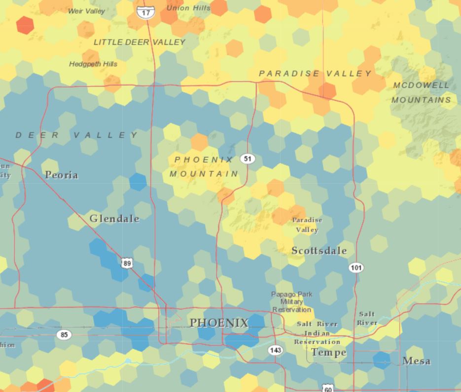
Arizona 2018 Invasive Plant Treatment Prioritization - Phoenix areaThe intent of the Arizona 2018 Invasive Plant Treatment Prioritization (IPTP) analysis is to:

  • Rapidly and strategically assess Arizona’s invasive plants management data
  • Use data to inform DFFM future priorities in Forest Health planning
  • Account for existing invasive plant management efforts from local to federal level
  • Keep spatial and quantitative analysis simple and transparent
  • Generate summaries and geospatial products for internal and public dissemination

The analysis and products will inform future DFFM priorities for program delivery and may be used directly by communities for their management needs.  


Note: Arizona-wide top priority areas are not necessarily more important for management decision making than local high priority areas within communities, watersheds, road and drainage reaches, and within ecological regions.

Products and Services

2018 Arizona Invasive Plant Prioritization Report cover2018 Arizona Invasive Plant Treatment Prioritization Report

The IPTP Report covers in detail the analysis' purpose, methodology, and results.  

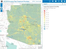
2018 Arizona Invasive Plant Prioritization Web Map2018 IPTP Web Map

View the results in an interactive web map. 

  • High priority = 1 or red; low priority = 0 or blue
  • Zoom in, pan, turn on the legend
  • Click on analysis hexagons to view their sub-index scores
  • Explore 8 parameter layers used to create the priority map (zoom in for better performance)

Download IPTP GIS Data

2018 Arizona Invasive Plant Treatment Prioritization GIS data (hosted by AZGeo Hub) 
GIS data of analysis results (Hosted Feature Service). 


USDA Forest ServiceMajor funding provided by the USDA Forest Service. 

In accordance with Federal law and U.S. Department of Agriculture policy, this institution is prohibited from discriminating on the basis of race, color, national origin, sex, age, or disability. (Not all prohibited bases apply to all programs.)


Use Disclaimer

Use is granted to public agencies, educational institutions, non-profit organizations and private individuals for non-commercial purposes. For commercial use of the Department of Forestry and Fire Management maps and data see Arizona Revised Statutes 39-121.03. The Department makes no warranties, implied or expressed, with respect to the accuracy of and the use of this data for any specific purpose. Users are required to make their own assessment of the data for any specific use.

Disclaimer of Non-Endorsement

References herein to any specific commercial products, process, or service by trade name, trademark, manufacturer, or otherwise, does not necessarily constitute or imply its endorsement, recommendation, or favoring by the Department or USDA Forest Service. The views and opinions of individuals expressed herein do not necessarily state or reflect those of the Department or USDA Forest Service, and shall not be used for advertising or product-endorsement purposes.

Geospatial Disclaimer

Property line representations and/or any other type of boundary, linear or point location representations contained within this data or displayed within this product are approximate, and cannot be used for authoritative location purposes. Users should independently research, investigate and verify all information before relying on it or using it in the preparation of legal documents. Legally-defensible property boundaries can only be established by state-registered professional land surveyors. A list of Arizona Registered Land Surveyors is available at btr.az.gov.
Tweets by @azstateforestry

Arizona State Seal
Contact Us
Department of Forestry and Fire Management
1110 West Washington St #500
Phoenix, AZ 85007
Find in Google Maps
Phone: (602) 771-1400
Map Image

Footer Nav

  • Statewide Policies
  • Site Map